TO SANTIAGO DE COMPOSTELA (or Rome?)
Need more information: marlaine@home.nl
Click here for the E2-E9 from Hook of Holland / Hoek van Holland – Nice (Deltapad)
In May 1997 we have finished the long distance hiking route ‘Het Pieterpad’ in Holland. We have enjoyed it very much and decided to continue our route to the south. We’re now planning the last 120 kilometers in Spain towards Santiago de Compostela. We will tell you more about our experiences.

We have read “Onderweg naar Compostela. Van LePuy naar Santiago de Compostela”: Herman van Hilst-Elmar Wandelgidsen, ISNB 90 389 00562, ‘Wat blijft is de Camino’ – Jeroen Gooskens: Op Lemen Voeten 99-2 blz. 14-16 and Time-out : Reiswijzer en avontuurlijk verslag van onze voetreis naar Santiago de Compostela van Fer en Loes Daniëls (dutch).
- GR5 in Belgium
- GR5 in Luxemburg
- GR5 in France – Lorraine
- GR5 in France – Les Vosges
- GR5 in France – Jura
- GR5 in France – Alpes
- GR5 and Santiago Route (der Jakobsweg) in Switzerland
- GR65 Geneve – le Puy-en-Velay
- GR65 in Southern France (Le chemin de St. Jacques from le Puy-en Velay)
- The Vézelay Route to Santiago de Compostela (GR654)
- Le Chemin d’Arles (GR653) (Arles – Puente la Reina)
- The Santiago Route in Spain
- Links to more GR5, GR65 and Santiago and other pilgrim-sites
We use the Topoguide GR5 – ‘Noordzee – Riviera. Part Maastricht – Spa – Ouren – Diekirch’, ed. SGR (Les Sentiers de Grande Randonnée), Postbox 10, B- 4000 Liège (Luik).
– July 20 1997: St. Pietersberg – Visé (28 km.). Interesting places: Fort Eben-Emael (Second World War) , Le Tour d’Eben-Ezer.
– October 22 1997: Visé-Nessonvaux (31.8 km.). Interesting places: Ferme de Cromwez, the village of Dalhem, Domaine de Wégimont.
– December 23 1997: Nessonvaux-Spa (25.4 km.). Interesting places: Banneux-Notre-Dame, the Christmas trees outside every house of Winamplanche, Vallée du ruisseau du Vieux Spa, the city of Spa. In Spa you will pass the Spa Tourist Information (Place Royale). They have great info about the Ardennes and several GR-routes.
– February 25 1998: Spa – Stavelot/Amblève Bridge (17.9 km.). Highly recommended!! Very beautiful part of the GR5. Interesting places: Vallée de la Picherotte, la Fagne de Malchamps and the RAF Memorial, the descending into the Amblève valley.
– April 12 1998: Stavelot/Amblève Bridge – Vielsalm (15.6 km.)Interesting places: The city of Stavelot, the Stockeu (Eddy Merckx), the city of Vielsalm.
– October 29 1998: Vielsalm – Burg Reuland (26.7 km.) Interesting places: The old castle Hof Burg-Reuland.
GR5 in Luxemburg
– June 29th 2001: Burg Reuland – Rodershausen ( 27.4 km.) To the Peterskirche, the Ouren Bridge and Het Drielandenpunt (Belgium, Germany, Luxemburg) with the Europe Memorial. Then beautiful walk in the Our-valley where we got lost and ended in Heinerscheid. From there another 10 km. to Rodershausen, so at the end we walked about 40 km.
– July 1999: Rodershausen – Vianden (28.9 km.) A long (8 hours) and hot (30 degrees Celsius) day of climbing and descending in the hills. We were exhausted but the drinks and ice in the evening were very good.
– July 1999: Vianden – Gilsdorf / Diekirch (15.3 km.) Interesting places: The old city of Vianden: castle, cableway and good restaurants.
From here we use the Topoguide GR5/E2 – ‘Noordzee – Riviera. Part Luxemburg – Lotharingen (Lorraine): Diekirch – Schirmeck’, ed. Grote Routepaden, Van Stralenstraat 40, 2060 Antwerpen.
The most beautiful part of the GR5 in Luxemburg you will find between the castle of Beaufort and Moersdorf (Petite Suisse / Europark I)
– July 1999: Gilsdorf – Grundhof (20.4 km.). Interesting places: The castle of Beaufort (Castellum Belforti) and the valley of the Haupeschbaach.
– January 2000: Grundhof – Echternach (10.4 km). Interesting places: the labyrinth of the Sieweschloeff (for rock climbing as well), the Teufelsschlucht and the city of Echternach.
– January 2000: Echternach-Moersdorf (18.8 km). Interesting places: the Tudor House in Rosport and the Girsterklaus.
– January 2000: Moersdorf-Grevenmacher (19.4 km). This is the region of the Luxemburg wine: “Waistrooss”, the Moselle.
– December 2000: Grevenmacher-Ahn (9 km) Winter in Luxemburg with nice snow storm. We missed the path down to Machtum (wrong indicated!!)and took the road in the direction Oberdonven – Niederdonven – Ahn.
– December 2000: Ahn-Remich (15.4 km) The GR5 in the vineyards, ending in the beautiful ‘Heidbaach’ and the ‘Esplanade’ of Remich.
– December 2000: Remich-Aspelt (23.2 km) Almost a whole day in the vineyards again, 591 steps downstairs to Wintrange, in the nice place Mondorf-les-Bains we have followed the river ‘Gander’ on the border of Luxemburg and France. Altwies and next stop Aspelt – last stop in Luxemburg
– May 2002: Aspelt – French border (Rumelange) (20.4 km) Deviation in Aspelt caused by works on a new autoroute. We got lost and followed the road to Evrange and Hagen, and finally picked up the GR5 again in Hellange. Between Burange and Tétange: Naturpark Haard. Now we understand why this region is called ‘The Land of the Red Soil’. From the border Luxemburg – France in the forest about 2 km after Tétange to the Rumelange railway station. If you want to go to the GR5 from this railway station: follow the climbing road at the other side of the road (Rue St. Joseph – Wuedert) and follow the yellow triangled signs for about 1 km.
GR5 in France – Lorraine
France – Lorraine: http://www.crt-lorraine.fr
– August 2003 Rumelange – Fontoy (21,2 km.). Hot day in the Lorraine (37 degrees Celsius). Well indicated diversion in Escherange and near Bellevue (new autoroute): follow the direction Bois de la Cote (Club Vosgien).
– December 2002 Fontoy – Neufchef (8,4 km.) (and 4 km. => Hayange railway station). Easy walk in muddy wood.
– August 2003 Neufchef – Rombas (10,4 km.). 35 degrees Celsius in Northern France. Fortunately forest and shadow most of the time.
– May 2002: Rombas-Ternel (13.4 km). Deviation in Rombas. The GR5 crosses the Rombas city center to the Fond Saint-Martin fun park with -as we were told- Europe’s highest climbing wall. Missed a curve at the end of the park and ended up in Malancourt to find the GR5 again at ‘La Croix David’.
– August 2003: Ternel – Lorry les Metz (11.2 km.). Meeting with dutch girls on the GR5 between Norroy-le-Veneur and Plesnois. Several well indicated diversions.
– July 2001 (from Metz railway station in 1.30h => Lorry les Metz): Lorry les Metz-Ars sur Moselle (12.2 km). Between Lorry les Metz and Plappeville route very poor indicated! Beautiful views on the city of Metz. In Sky Chazelles one of the founders of the European Community -Robert Schumann- was living.
– August 2003: Ars sur Moselle – Onville (19.8 km.). Almost 40 degrees Celsius. Meeting with two deer and a fox.
– December 2002: Onville – D 105 (near Montauville (20 km) (and 3 km. => Pont-à-Mousson railway station) . Several (well indicated) diversions due to the storm of December 2000. Points of interest: the remainings of the Prény-castle and the ‘Monument de la Croix des Carmes’ on the World War I battle field.
– July 2004: D 105 (Cimétière Militaire de Péteant near Montauville) – Rosières en Haye (22.6 km). Route changed near the gap Grimo-Santé (don’t go to the left but follow the path to Saint-Jean). Very lovely and quiet near Saint-Jean. Route changed again in Martincourt, well indicated. A lot of noise in Rosières en Haye caused by a military airport.
– July 2006: Rosières en Haye – Liverdun – Custines (18 km). Beautiful view on the Mosel river from Liverdun-Haut. Route changed in the forest between Liverdun and Custines.
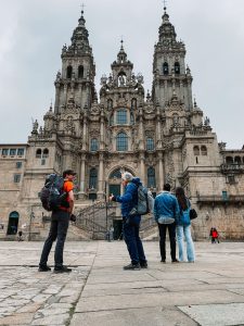
April 2023: Santiago de C
– July 2009: Custines – Blanzey – Brin sur Seille (20.6 km) . Blanzey: Abbaye_de_Sainte-Marie-au-Bois.
– February 2004: Brin sur Seille – Grémecey (6.6 km) . Nice walk in the hills
– July 2004: Grémecey – Salonnes (10 km) . We got lost in the Fôret de Grémecey. Not our fault this time, route very poor indicated. Ended up in Coutures near Château Salins (2.45 hours) => 4 km. by car to Salonnes.
– February 2004: Salonnes – Blanche-Église (16.6 km) (and 2 km. => Dieuze) . The town of Vic sur Seille with the Musée Départemental Georges de la Tour and the little village of Marsal with the Maison du Sel. Snow storms and temperature below zero (we were thinking about the temperatures during our last visit of August 2003).
– July 2009: The D22a between Blanche-Église and Dieuze – Diane-Capelle (24.2 km) . Via the ‘Route Forestiere Chemin Noire’ to the Étang de Lindre. Route changed near Assenoncourt, lost the signs and had to walk another 5 km. Found the route again in Fribourg. After Fribourg first view on the Vosges and the Étang du Stock. From Le Domaine Les Bachats nice walk (Étang du Stock) to the bridge in Diane-Capelle. It seems that a lot of germans have a holiday house near the Étang.
GR5 in France – Les Vosges
– July 2004: Diane-Capelle – Fraquelfing (14.8 km) . More than 5km. along the canal. On the pedestrian bridge between Diane-Capelle and Gondrexange beautiful view on the lakes and the two canals. Near Landange nice view on the Vosges.
– July 2004: Fraquelfing – Saint-Quirin (9 km). From Métaire de Saint-Quirin beautiful view on the Vosges and Le Donon.
– July 2004: Saint-Quirin – Col de l’Engin (22.2 km). From Saint-Quirin we followed the signs direction Col de Donon. This seemed to be an other route and not the GR5 (for the GR5 you need to cross the river at a higher point, near the church of Saint-Quirin). Near Le Tête du Frésillon the signalisation to Le Donon stopped. With the help of our compass, a topo guide and some luck we found the GR5 again near La Borne Brignon, got lost again and finally found the GR5 at Croix Simon. We walked 5 hours. Picture: the house where we stayed (in Turquestein).
– July 2004: Col de l’Engin – Schirmeck (14.6 km). On top of Le Donon (1008 m) a Gallo-Roman settlement and a TV-pylon (picture: dutch garden gnome and the TV-pylon).
Beautiful views on the Vosges and the Mosel valley. From the road at the Col du Donon route very poor indicated so we mainly followed the D 392 to Schirmeck.
– July 2010: Schirmeck – Camp Le Struthof (1h 45 min) (and back to Schirmeck 1h 30 min). Cold and rainy climb to the former Natzweiler concentration camp.
– April 2012: Camp Le Struthof – Le Hohwald (3h) Snow storm. Forest. Champ du Messin, Col de la Katzmatt, Rocher de Rathsamhausen.
– April 2012: Le Hohwald – Barr (2h 30 min). Forest. We missed the Couvent du Mont-Sainte-Odile. Have to go back to see what went wrong and where.
– July 2010: Barr – Neumatten (5h 30 min). Climb to Le Gruckert and La Tour de L’Ungersberg. Lost the route twice while descending L’Ungersberg (and walked to Nothalten). Lots of vineyards.
– July 2010: Neumatten – Châtenois (4h). Ruine du Bernstein and Ruine de l’Ortenbourg.
– July 2010: Châtenois – Thannenkirck (4h). Parc animalier ‘la montagne des singes’ in Wick and the beautiful Château du haut-Koeningsbourg.
From here we use the Topoguide GR5 – ‘Crête des Vosges – Parcs naturels régionaux des Vosges du Nord et des Ballons des Vosges: Wissembourg – Fesches le Châtel’, Topo-guide des Sentiers de Randonnée, Fédération Française de la Randonnée Pédestre.
For bus time tables in the region: Bus CTRB
– July 2001: Ferme du Ballon d’Alsace – Malvaux (2.30h). We had planned to walk to Giromagny but not far from the Ferme du Wissgrut we got lost after the sign “Attention. Des animaux. Danger” and a herd of bulls in front of us. So we finally ended on the D465.
– July 2001: Malvaux at the D465 – Chalonvillars (5.30 h). In Giromagny (1 hour) we have found the GR5 again. Between Evette-Salbert and Chalonvillars serious climb to Le Fort de Salbert with beautiful views on Belfort, Le Pays de Montbéliard, Les Vosges, Le Jura and Les Alpes.
– July 2001: Chalonvillars – Brévilliers (2.15 h). Easy walk mainly in the wood.
– July 2001: Nommay – Fesches le Châtel (1.25 h). Nice and easy walk along the lake (swimming possiblities) and the canal.
GR5 in France – Jura
From here we use the Topoguide GR5 – ‘Lacs et Plateaux du Jura – Gorges du Doubs: Nommay – Nyon’, Topo-guide des Sentiers de Randonnée, Fédération Française de la Randonnée Pédestre.

– July 2014: Mouthe – Chaux Neuve / Le Lernier (2h). Work in the forest. Deviation => D437 => Chaux Neuve => Le Lernier
– July 2014: Le Lernier – Chapelle des Bois (3h + 4h). Got lost in the forest first. Tried again starting in Chapelle des Bois. Meeting with hiker who also had problems finding the path near Le Lernier. Near Chaux Neuve / Le Lernier: ski jump (picture).

– July 17th 2014: Chapelle des Bois – Le Vivier de Bois d’Amont (6h). The day of the MH17 plane crash. From Chapelle des Bois steep climb (2 hours) to La Roche Bernard. Beautiful view on the Lac de Bellefontaine. Descent to Le Vivier de Bois d’Amont (D29).
– July 2014: Le Vivier de Bois d’Amont – Les Rousses (2.30h).Couldn’t find the path in the forest so followed the D29 along the Lac des Rousses to Les Rousses.
GR5 and Santiago Route (der Jakobsweg) in Switzerland
– October 2000: Les Rousses – La Cure / Swiss border (12 km). From the nice wintersport place les Rousses to the border between France and Switzerland. It has to be said the customs there are not the most sympathetic people we have met during our trip
– October 2000: La Cure / Swiss border – Nyon (Lake of Geneva-Switzerland) (21 km). Beautiful views on the lake and the Alps on a long descent.
The GR5 continues in the Alpes on the other side of the lake to Nice and for instance Rome by the Via Francigena or E1.
For Santiago de Compostela: follow the Der Jakobsweg, part Nyon – Genève and from Genève: Le Chemin de Saint-Jacques-de-Compostelle de Genève au Puy-en-Velay, La route de Genève( Via Gebennensis) (Association: Chemins de Compostelle en Rhône-Alpes). This great info we received from Jan and Erna Brilleman.
– August 2006: Nyon – Genève (22 km) . There are two routes, the crowded road Nyon – Genève and a foot path. Just outside Nyon the UEFA Headquarters (European Football Association). Now and then beautiful views on the lake. In Genève follow the lake from La Perle du Lac.
We used: Hartmut Engel “Schweiz: Jakobsweg. Von Bodensee zum Genfer See”, Band 117 Outdoor Handbuch, Conrad Stein Verlag. ISBN 3-89392-517-1
In Genève: at the Carouge bridge (Le Pont de Carouge) the footpath Genève – Le Puy-en-Velay starts. To get there (from the Rhône river -Pont de l’Ile- to the Pont de Carouge): Place Bel Air, Rue de la Cité, Grand Rue, Rue du Puits St. Pierre, Rue Barbian, Cours St. Pierre, Rue de Hôtel de Ville, Place du Bourg du Four, Rue Chausse Coq, Rue St. Léger, Place des Philosophes, Rue Prévost Martin, Rue de la Ferme, Pont de Carouge. Walk the GR65 Geneve – Le Puy-en-Velay
GR 65: Le chemin de St. Jacques from Le Puy-en-Velay
We use the Topoguide GR65 – Le chemin de St. Jacques: du Puy-en-Velay à Roncevaux par le GR 65′. Ed. Randonnées Pyrénéennes – ISBN 2 905521 50 3. For more details the GR65 Site: ‘Le chemin de St. Jacques.
– July 2011: Le Puy-en-Velay – Montbonnet (4 hours) From the Cathédrale in Le Puy-en-Velay (many steps to get there) to the D589 in the village of Montbonnet. The cathedral has been a Unesco World Heritage Site since 1998. The GR65 starts with a long climb.
– July 2013: Montbonnet – Monistrol d’Allier (4 hours). Difficult from Saint-Privat d’Allier.
– July 2013: Monistrol d’Allier – Saugues (3 hours). Steep climb from Monistrol to Escluzels. Steep descent from the D589 to Saugues. From Monistrol to Aumont-Aubrac daughter Hannah as private driver.
– July 2013: Saugues – Chazeaux (3.30 hours).
– July 2013: Chazeaux – Le Domaine du Sauvage – Saint Alban sur Limagnole (4.30 hours). After le Domaine du Sauvage la Chapelle Saint-Roch. Just missed the thunderstorm.
July 2013: Saint Alban sur Limagnole – Aumont Aubrac (3.30 hours). Hot. Helped hiker who ran out of water. Back in Aumont-Aubrac after 6 years.
– August 2007: Aumont-Aubrac – Rieutort d’Aubrac (4 hours). From Aumont-Aubrac to La Chaze de Peyre and Lasbros. In Finieyrols the house where Louis Dalle was born. Between Le Roc aux Loups and Rieutort d’Aubrac a bull on the path. This is the region of Les Monts d’Aubrac, the famous Aubrac race and the aligot.
– August 2007: Rieutort d’Aubrac – Aubrac (3.30 hours) Nice place of Nasbinals. Very rainy day.
– July 2007: Aubrac – St. Chely d’Aubrac (2 hours) and St. Chely d’Aubrac – Saint-Côme-D’Olt (4 hours)
– July 2007: Saint-Côme-D’Olt – Espalion (2 hours) In Espalion: the Hal’t Pèlerin (picture).

– July 2007: Espalion – Estaing (3 hours) Vallée du Lot and Estaing – Golinhac (4 hours)
– August 2007: Golinhac – Espeyrac (2 hours) More than 35 degrees Celsius.
– August 2007: Espeyrac – Conques (3.30 hours) Via Senergues arrival in Conques: Grand site de France
– July 2008: Conques – Decazeville (5 hours) Leave Conques via the old Rue Charlemagne and climb to La Chapelle St. Foy with beautiful views on Conques.
– July 2008: Decazeville – St. Felix (6 hours) La Chapelle de Guirande and Le Ruisseau de Guirande.
– July 2008: St. Felix – Figeac (2.30 hours) In Figeac Hotel Le Pont d’Or where the Silence-Lotto Tour de France team stayed (Cadel Evans, Robby McEwen).
– July 2008: Figeac – Faycelles (2 hours)
– July 2008: Faycelles – Cajarc (6.30 hours) Near Beduer we made a mistake and followed the GR651. From Boussac via the D48 and D19 to Gréalou and Cajarc. Back in Cajarc with the Africajarc after 5 years.
Public transport: Le bus de Lot
– August 2003: Cajarc – Mas del Pech (2 hours). Nice place at the river Lot. A lot of hikers on this part of the route. Deviation at Mas de Couderc. Thunder in the air.
– August 2003: Mas del Pech – Varaire (3.30 hours). Again: a lot of hikers on this part of the route.
– August 2003: Varaire – Bach (1.15 hours). Lots of dead trees because of the dryness and heat.
– August 2003: Bach – Flaujac Poujols (3.30 hours). Clouded at last. Sandwiches in Mas de Vers. Just before Flaujac Poujols well indicated deviation (new autoroute).
– August 2003: Flaujac Poujols – Cahors (2.15 hours). 40 degrees Celsius. Meeting with a group of hikers hiding for the sun during their ‘siesta’. No rain in the region in the last 3 months. Nevertheless we found a ‘fresh campfire’ near Cahors and empty plastic bottles. How stupid can one be? Beautiful views on the beautiful city of Cahors.
– August 2003: Cahors – Labastide Marnhac (normally 2.30 hours)). Near the Pont Valantré in Cahors we made a mistake and followed the GR36 in stead of the GR65. From Flottes the road(s) to Labastide: 5 hours.
– August 2003: Labastide Marnhac – Montcuq (5 hours)). Nice place of Lascabanes with the Domaine de St. Gery and Montcuq.
– August 2009: Montcuq – Durfort-Lacapelette (Aube-Nouvelle) (6 hours)). Nice walk. Old village of Lauzerte. In Chartron ‘Pigeonnier Superbe’ . Chapelle and Lac St. Sernin.
– August 7 1997: Durfort-Lacapelette – Moissac (21 km.). The route has been changed here, so the route description in the book is completely wrong. The changes are very well indicated. Don’t forget to visit the abbey of Moissac.
– August 12 1998: Moissac – Saint-Antoine (31 km. – 7-8 hours)) Interesting places: the view on the Garonne and Tarn river, le Canal latéral à la Garonne, the city of Auvillar. This was exactly one month after Sem’s 11th birthday.
– July 2012: Saint-Antoine – via Miradoux => N21 near Lectoure (5.45 hours)) Back in Saint-Antoine after 14 years. Route has been changed. Extremely hot.

– July 2012: St. Avit-Frandat => N21 (new route) – Lectoure – Marsolan (5 hours). Between Lectoure and Marsolan not possible anymore to follow the road of the Chateau Mirail. Found the route again near Caumont.
– July 2012: Marsolan – La Romieu – Condom (6 hours). Up and down the hills. 36 degrees Celsius.
Near Condom (Gers): Chambres d’Hôtes – Au Vieux Pressoir
– July 2012: Condom – Montréal du Gers (4 hours). In Montréal du Gers the GR65 meets the Vézelay route
– July 2017: Arzacq-Arraziguet – Pomps (5 hours)
– July 2017: Pomps – Arthez de Bearn (3 hours)
– July 2017: Arthez de Bearn – Sauvelade (4 hours) Village of Maslacq and Sauvelade . Near Sauvelade: Gîte Lassegues (Castetner)
– July 2017: Sauvelade – Navarrenx (4 hours)
– July 2017: Navarrenx – Aroue (5.30 hours)
– July 2017: Aroue – Larribar-Sorhapuru (3 hours)
– July 2017: Larribar-Sorhapuru – Ostabat (2.30 hours) Meeting with Belgian family and climb to the Chapelle de Soyarza
– July 2017: Ostabat – Gamarthe (3 hours)
– July 2017: Gamarthe – Saint-Jean-Pied-de-Port (2.30 hours)  Saint-jean-Pied-de-Port has traditionally been an important point on the Way of St. James, the pilgrimage to Santiago de Compostela, as it stands at the base of the Roncevaux Pass across the Pyrenees. Pied-de-Port means ‘foot of the pass’ in Pyrenean French. The routes from Paris, Vézelay and Le Puy-en-Velay meet at Saint-Jean-Pied-de-Port and it was the pilgrims’ last stop before the arduous mountain crossing.

- In dutch: Wandelgids Spaanse St. Jacobsroute, ANWB – ISBN 90 18 012831
- Camino de Santiago – pilgrimage walk across the north of Spain.

Sites about the routes to Santiago de Compostela, Rome and Jerusalem and the GR5: - Caminosantiago.com
- The official dutch homepage for pilgrims to Santiago de Compostela
- Paulo Coelho – Pilgrimage to Santiago
- Camino-de-santiago.pagina.nl
- Association: Chemins de Compostelle en Rhône-Alpes
- The Way of St. James in the Ariège Pyrenees
- Le Chemin de St. Jacques en Ariège-Pyrénées
- Everything about Santiago de Compostela – Galicia, Spain
- Santiago.eigenstart.nl
- Via Francigena (from Canterbury to Rome)
- EUROVIA – Website of the Association for The Establishment of European Pilgrimage Routes
- Frank Maes op weg naar Compostela (dutch). From Belgium to Compostela
- Dagboek van een voetreis naar Santiago de Compostela door Jan Brilleman (dutch). Diary – To Santiago de Compostela
- GR5 -Hoek van Holland-Nice (dutch)
- The GR5- Het loopavontuur van Fer en Loes Heeremans (dutch)
- The GR5-E2 from Belgium (Spa) to the Jura (Thonon les Bain) and Alps by Wouter Hogendorp (dutch)
-
© Ton & Polle de Maagt 1997-2023 Last updated on January September 21st 2023