
Grand Canyon du Verdon: maps, history, hiking, rafting
There are two GR routes near and/or through the Gorge du Verdon:
– the GR99
and
– the GR4: Fred Triep: een voettocht langs de GR 4.
– and there are several other routes in and near The Gorge (for instance the famous -but very crowded- Route Martel, part of the GR4).
– From Le Point Sublime: the GR49 to Saint-Raphaël
We have used the guide: ‘Tien paden voor voettochten in en rond het ravijn. Gids van de voetpaden van de Verdon’ – Frank Ricordel. We have bought it in Moustiers-Ste-Marie. Also available in english, german and french.
In dutch also: ‘Door de heuvels van de Provence naar de Gorge du Verdon’ (Op Lemen Voeten 99-3 blz. 21-23).
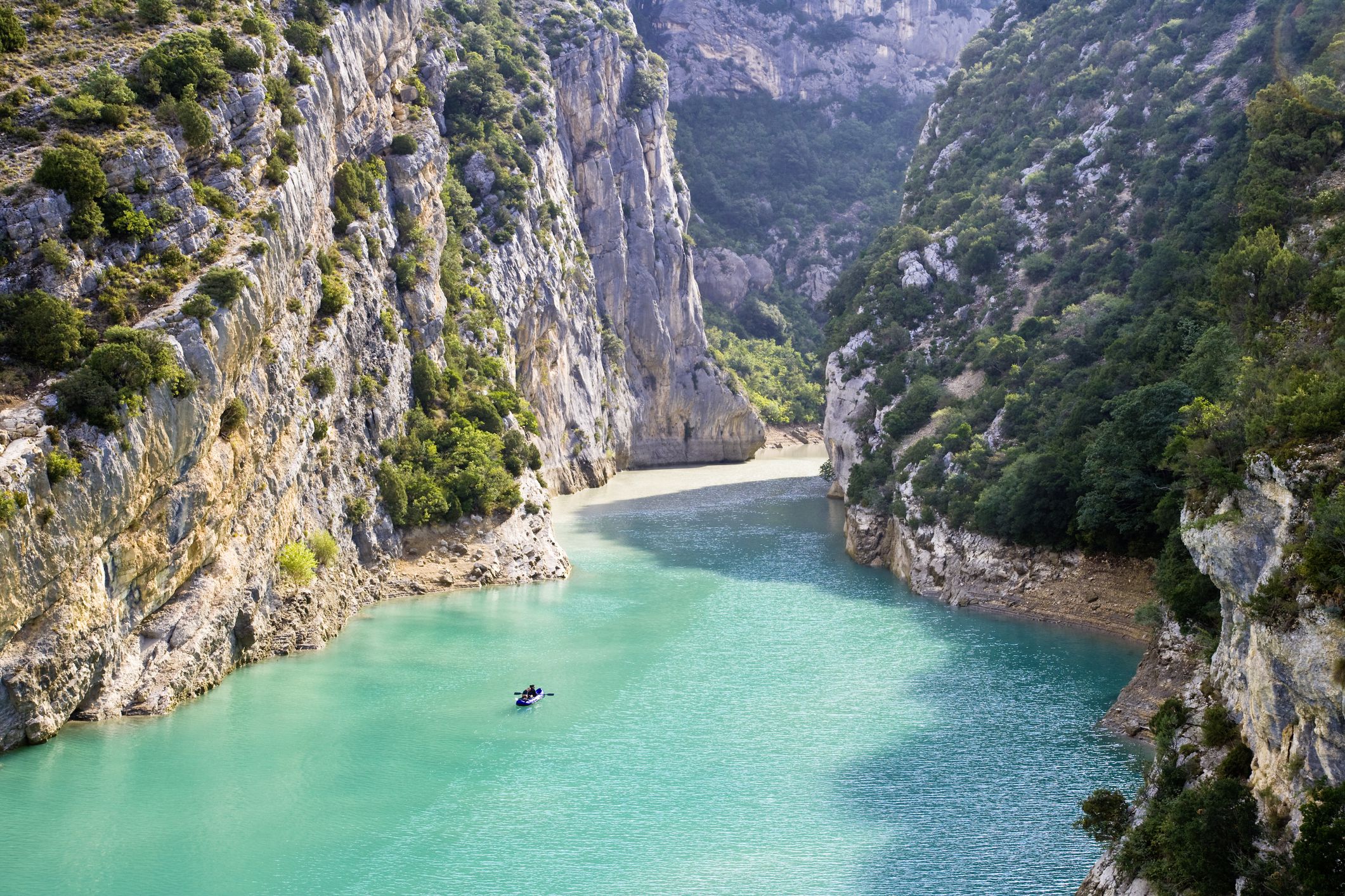
Hiking in the Gorges can be dangerous because of the sudden changes in the water level, caused by the upstream dams
Need more information in english: marlaine@home.nl
Wij hebben zelf gelopen:
– het Sentier Martel vanaf Chalet La Maline via de Couloir Samson naar de Point Sublime (4-5uur). Begint met een lange afdaling de Gorge in, halverwege de tocht 252 treden naar beneden via de Escalier de l’Imbert en tenslotte door een drietal tunnels. Een zaklamp is daar niet overbodig. Dit pad is dus onderdeel van de GR4. Bij de Point Sublime begint de GR49 die naar Saint-Raphaël aan de Middellandse Zee loopt.
– Vanaf de Col de l’Olivier (tussen Moustiers en La Palud) via de (door een vloedgolf weggeslagen) oversteekplaats van de Mayreste en de waterval van St. Maurin terug naar de Col de l’Olivier (vanaf de kantonwoning stukje over de zeer drukke weg). Duur ongeveer 3 uur.
– Les Salles sur Verdon – Les Salles sur Verdon I. Vanaf het dorp een klein stukje over de weg richting Aups. Daar kun je de GR99 oppikken richting Aiguines. Vanaf Aiguines via de weg en/of bospaden terug (in westelijke richting naar beneden kom je altijd bij het Lac de Sainte Croix en vanzelf weer in Les Salles sur Verdon uit). Halve dag.
– Les Salles sur Verdon – Les Salles sur Verdon II. Vanaf het dorp naar beneden naar het Lac de Sainte Croix. In noordelijke richting over het strand naar de brug bij de ingang van de Gorge du Verdon. Terug over de paden boven het strand en het Lac. Halve dag.
 Foto’s nieuwe brug: Albert Hogenkamp

The GR99:
We have used the guide: Topo-guide des sentiers de randonnée – De la Méditerrannée aux Gorges du Verdon – Fédération de la Randonnée Pédestre, ISBN 2-85699-626-4.
– 22nd of August 1998: Baudinard sur Verdon – Bauduen– 13 km. – 3 hours: beautiful panoramic views on the Lac de Ste. Croix, the mountains of the Haute Provence and the hills of the Moyen Var.
– 20th of August 1998: Bauduen – Les Salles sur Verdon – following the Lac de Ste. Croix – 2 hours: beautiful panoramic views on the Lac de Ste. Croix. Some difficult passages (rock climbing).
– 23th of August 1998: Bauduen – Les Salles sur Verdon – following the Le Plateau du Défens – 2 hours.
– August 1997: Les Salles sur Verdon – Aiguines – 2 hours: beautiful panoramic views on the Lac de Sainte Croix. In Aguines: castle, very good camping site and information on the GR-routes.
 Photos new bridge: Albert Hogenkamp |
– 25th of August 1998: Aiguines – Auberge des Cavaliers, following Le Grand Margès – 5-6 hours. It is advised to follow the alternative route (Variante Col d’Illoire) in case of bad weather!! The first hours are difficult (climbing). Beautiful panoramic views on the Gorge du Verdon and the Lac Ste. Croix again. From the Auberge the Cavaliers it is possible to descend in the Gorge, but in 1998 it was not possible to cross the river and go to the GR4 (bridge damaged) !! Albert Hogenkamp, who has a lot of experience in hiking in the Gorge, wrote us that in 2003 there was a new bridge. Following the river you can go to the l’Imbut in a couple of hours. Back to Les Cavaliers following the same route or by climbing to the road by following the very spectacular, vertiginous Sentier Vidal.
| © Ton & Polle de Maagt 1997-2011 Last updated on the 2nd of December 2011 |